Recharge

What is Recharge?

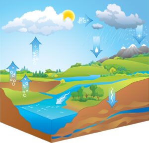
Recharge is the process through which surface water reaches groundwater. This can happen when precipitation infiltrates to an aquifer or when surface water bodies, such as lakes, rivers, and wetlands directly exchange water with an aquifer. It is through this natural process that our drinking water source gets replenished. Water can also get transferred to the aquifers through the confining units (also called aquitards) in between, but recharge is generally described by the water inputs from precipitation and surface water bodies.


Knowing how much water is being recharged into the aquifer is critical in determining the sustainability of our groundwater resources. Think of our aquifer as being a box. We have a good idea about the size of this box and the types of materials in it. Output from the box would be pumping, where we extract groundwater for municipal, industrial, and agricultural uses. These outputs can be measured easily by placing a meter on a pump or estimating irrigation to a field. Recharge would be the input into the box, but unfortunately, it is something we do not have an accurate measure of for our region.

CAESER has been physically measuring recharge to the Memphis aquifer and surficial (or shallow) aquifer for the past 20 years at several locations: the Pinecrest Conference and Retreat Center in Fayette County, the Sandy Creek restoration site in Madison County, and on farms in Gibson, Carroll, Haywood, and Dyer counties. Measuring recharge requires a suite of methods that may include well installation, regular monitoring of climatic data on a daily scale, assessing soil moisture fluctuations at near-surface (< 10 ft) to 150+ feet below the ground surface, stream gaging, continual observation of groundwater levels, and numerical modeling, plus others.

We know the box and we know what’s leaving the box, but we don’t have a good handle on what’s entering the box. This complicates us determining sustainability of this value water resource.

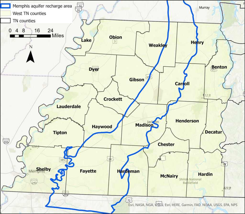
Estimates of recharge have been made using modeling, but these results have not been tied to physical measures of recharge to validate what the models suggest. The Memphis aquifer serves as a major source of water in west Tennessee. Its recharge area forms a broad north-south swath that covers portions of 13 of the 21 counties of west Tennessee.

>

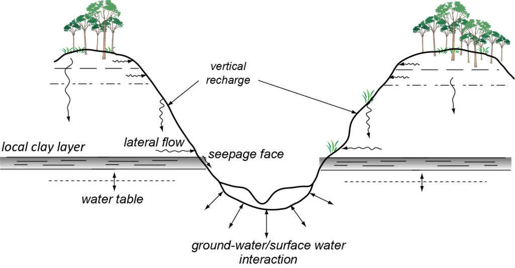
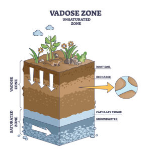
Quite astonishingly, at Pinecrest we observe that the infiltration of precipitation once past the root zone (this depth gets you past the effects of evapotranspiration) takes approximately 100 years to reach the groundwater surface. However, if you were to walk through the woods about 1,000 feet to a little upland stream valley, we see recharge occurring on a seasonal time scale, which means fast! That’s a remarkable time difference over such a small horizontal distance! Such realizations are critical for guiding development in the recharge area of the Memphis aquifer and evaluating the sustainability of our precious groundwater resources.

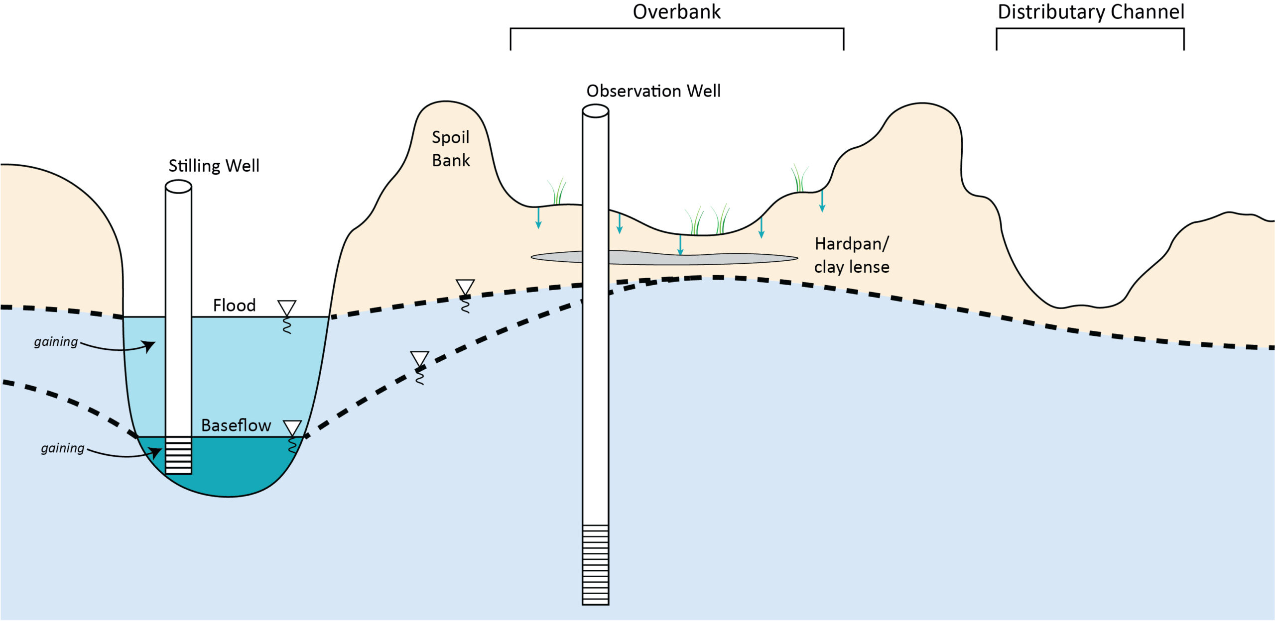
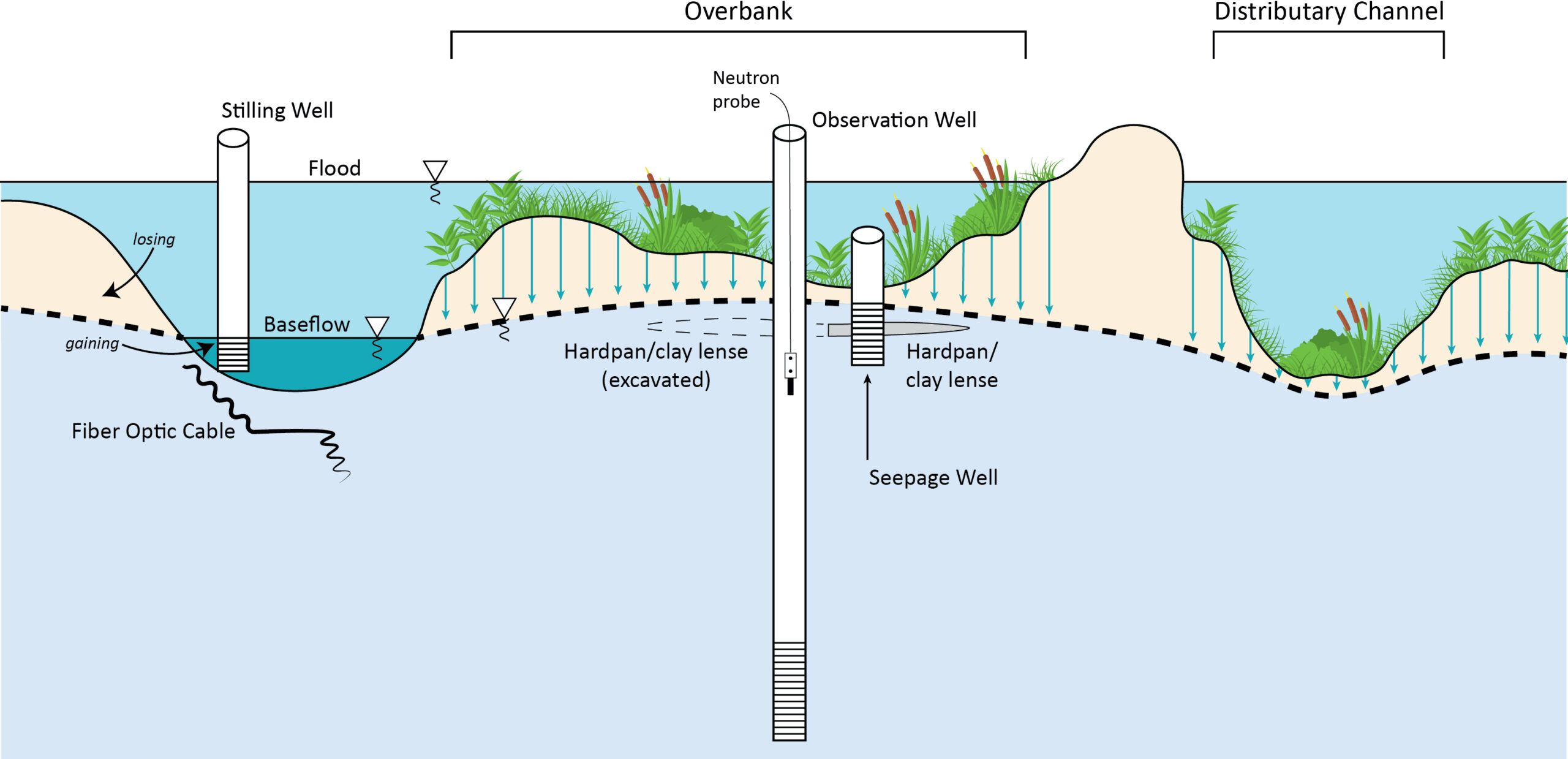
Stream water exchange with groundwater varies under a variety of conditions, the biggest of these is the difference in water levels. During the wet season, streams flow full and contribute water to groundwater. Conversely, in the dry season groundwater gives water to streams, that is why rivers have water even when there is no rain. CAESER works closely with the West Tennessee River Basin Authority (WTRBA), an agency under the Tennessee Department of Environment and Conservation, that restores degraded streams to natural conditions across west Tennessee. Many of these degraded streams have deeply incised channels and groundwater levels near these streams are lower than normal. Also, during large storm events, overbank flooding is limited due to the deeply incised channel that can contain these flood volumes, increasing erosion and modifying recharge rates.

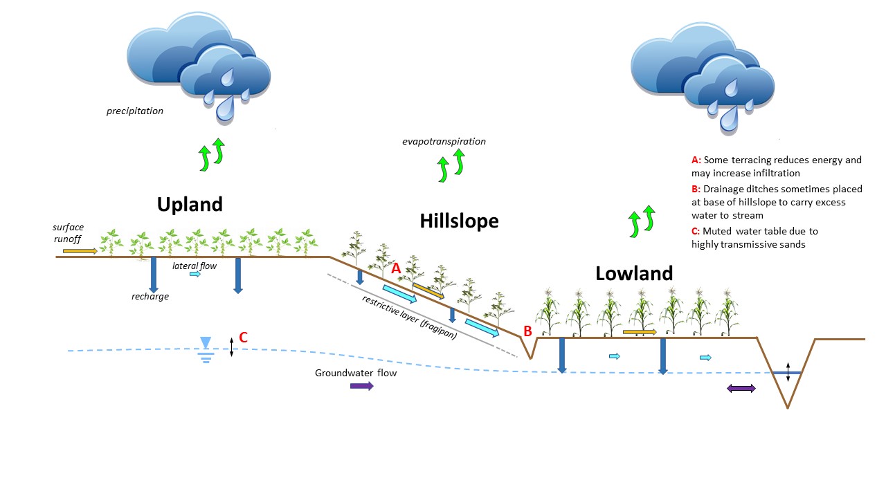
CAESER works with farmers in west Tennessee through funding from the Tennessee Department of Agriculture (TDA) and collaborates with the University of Tennessee Institute of Agriculture (UTIA). These studies indicate an interesting dynamic of recharge that varies from hilltop to hillslope to bottomland, a landscape sequence found throughout much of west Tennessee. Hilltops have a good distance for recharge to travel from below the root zone to the groundwater surface, like we see at Pinecrest. On the hillslope, a “fragipan” restricts extensive downward movement but more so supports lateral movement atop this restrictive layer towards the bottomland. Bottomland areas see shallow groundwater levels that does support recharge depending on its closeness to the root zone and discharge to nearby streams.

CAESER continues its important work on recharge to our regional groundwater system through support from TDA, WTRBA, collaborations with UTIA, and private donations by International Paper, Chemours and Georgia Pacific.

Check Out Our Other Projects